-
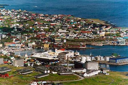
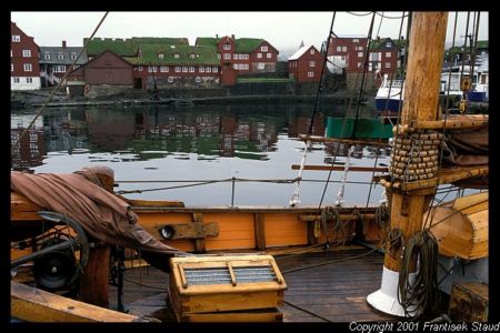
Farerų salos
- daugiau apie šią šalį
- Afganistanas
- Airija
- Albanija
- Alžyras
- Amerikos Samoa
- Andora
- Anglija
- Angola
- Antigva ir Barbuda
- Argentina
- Armėnija
- Aruba
- Australija
- Austrija
- Azerbaidžanas
- Bachreinas
- Bahamų Sandrauga
- Baltarusija
- Bangladešas
- Barbadosas
- Belgija
- Belizas
- Beninas
- Bermuda
- Bisau Gvinėja
- Bolivija
- Bosnija ir Hercogovina
- Botsvana
- Brazilija
- Brunėjus
- Bulgarija
- Burkina Fasas
- Burundis
- Butanas
- Centrinė Afrikos Respublika
- Čadas
- Čekija
- Čilė
- Danija
- Didžioji Britanija
- Dominika
- Dominikos Respublika
- Džersis
- Džibutis
- Egiptas
- Ekvadoras
- Eritrėja
- Estija
- Etiopija
- Farerų salos
- Fidžis
- Filipinai
- Folklando (Malvinų) salos
- Gabonas
- Gajana
- Gambija
- Gana
- Gernsis
- Gibraltaras
- Graikija
- Grenada
- Grenlandija
- Gruzija
- Guamas
- Gvadelupa
- Gvatemala
- Gvinėja
- Haitis
- Hondūras
- Honkongas
- Indija
- Indonezija
- Irakas
- Iranas
- Islandija
- Ispanija
- Italija
- Izraelis
- Jamaika
- Japonija
- Jemenas
- Jordanija
- Jungtiniai Arabų Emiratai
- Jungtinės Amerikos Valstijos
- Juodkalnija
- Kabo Verdė
- Kaimanų salos
- Kalėdų salos
- Kambodža
- Kamerūnas
- Kanada
- Kataras
- Kazachija
- Kenija
- Kinija
- Kipras
- Kirgizija
- Kiribatis
- Kokosų (Kilingo) salos
- Kolumbija
- Komorų salos
- Kongo Demokratinė Respublika
- Kongo Respublika
- Kosta Rika
- Kot di vuara
- Kroatija
- Kuba
- Kuko salos
- Kuveitas
- Laosas
- Latvija
- Lenkija
- Lesotas
- Libanas
- Liberija
- Libija
- Lichtenšteinas
- Lietuva
- Liuksemburgas
- Madagaskaras
- Majotas
- Makao
- Makedonija
- Malaizija
- Malavis
- Maldivai
- Mali
- Malta
- Marianos Šiaurinės Salos
- Maroko
- Maršalo salos
- Martinika
- Mauricijus
- Mauritanija
- Meksika
- Mianmaras (Birma)
- Mikronezijos Federacinės Valstijos
- Moldova
- Monako
- Mongolija
- Monseratas
- Mozambikas
- Namibija
- Naujoji Kalėdonija
- Naujoji Zelandija
- Nauru
- Nepalas
- Niderlandai
- Niderlandų Antilai
- Nigerija
- Nigeris
- Nikaragva
- Niujė
- Norfolkas
- Norvegija
- Omanas
- Pakistanas
- Palau
- Panama
- Papua Naujoji Gvinėja
- Paragvajus
- Peru
- Pietų Afrika
- Pietų Korėja
- Pitkerno salos
- Portugalija
- Prancūzija
- Prancūzų Gviana
- Prancūzų Polinezija
- Puerto Rikas
- Pusiaujo Gvinėja
- Reunjonas
- Ruanda
- Rumunija
- Rusija
- Rytų Timoras
- Salomono salos
- Salvadoras
- Samoa
- San Marinas
- San Tomė ir Prinsipė
- Sant Lusija
- Saudo Arabija
- Seišelių salos
- Senegalas
- Sent Kitsas ir Nevis
- Sent Pjeras ir Mikelonas
- Sent Vinsentas ir Grenadinai
- Serbija
- Siera Leonė
- Singapūras
- Sirija
- Slovakija
- Slovenija
- Somalis
- Sudanas
- Suomija
- Surinamis
- Svalbardas
- Svazilandas
- Šiaurės Korėja
- Šri Lanka
- Švedija
- Šveicarija
- Šventos Elenos salos
- Tadžikija
- Tailandas
- Taivanas
- Tanzanija
- Terksas ir Kaikosas
- Togas
- Tokelau
- Tonga
- Trinidadas ir Tobagas
- Tunisas
- Turkija
- Turkmėnija
- Tuvalu
- Uganda
- Ukraina
- Urugvajus
- Uzbėkija
- Vakarų Sachara
- Vanuatu
- Venesuela
- Vengrija
- Vietnamas
- Virdžinijos salos (JAV)
- Vokietija
- Volisas ir Futūra
- Zambija
- Zimbabvė
- Torshavnas
- Kontaktai